
This page presents all available maps of Korosten district of Zhytomyr region. Choose an interactive (online) map or a static map of Korostensky district
See also maps of the city of Korosten
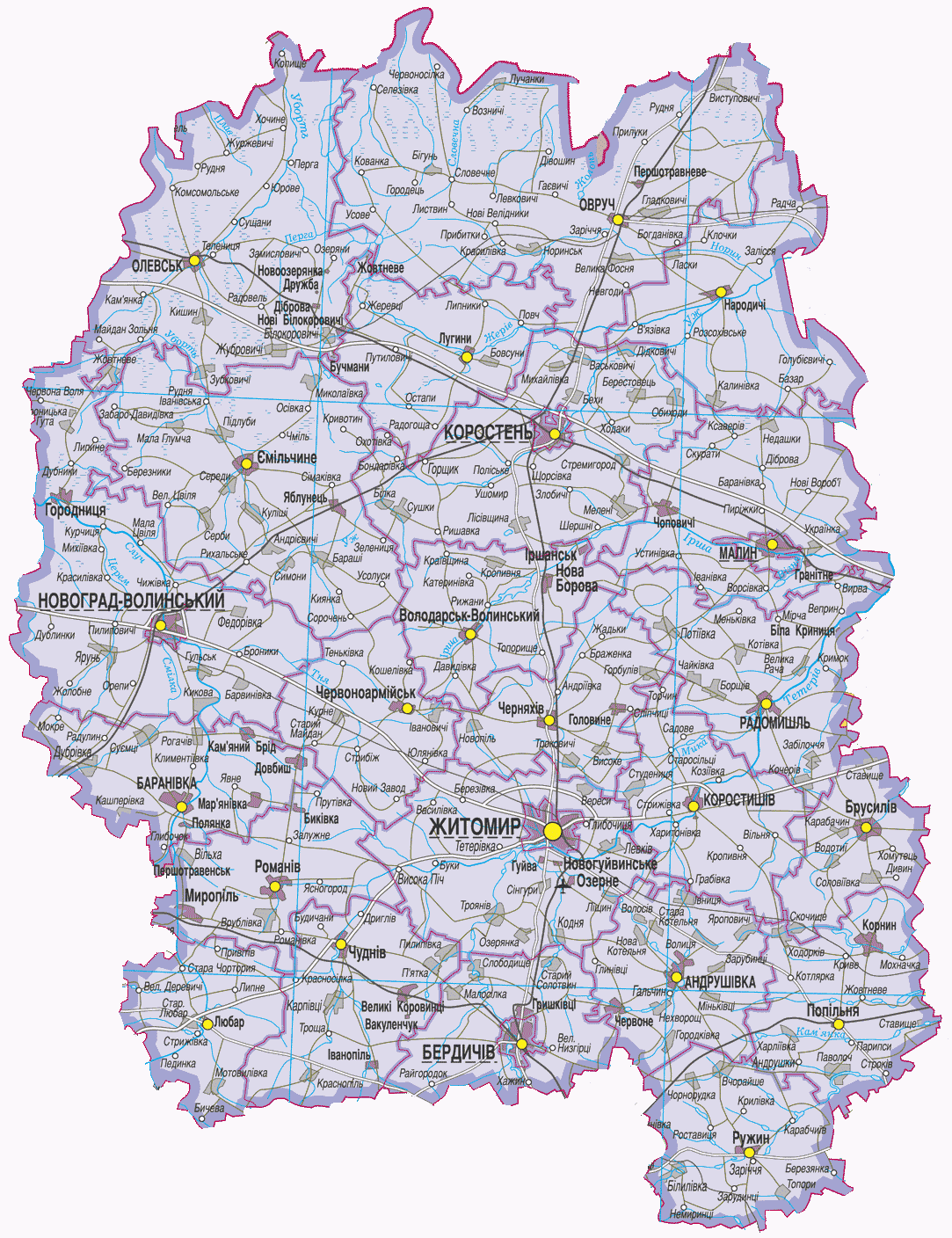
Map of the Korosten district with the largest villages (click on the map to enlarge the map to the size of the Zhytomyr region)
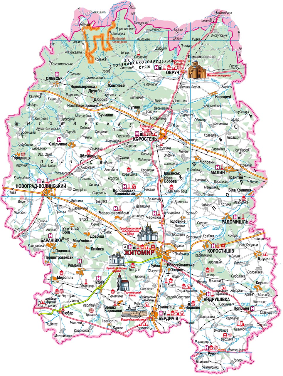
Map of the Korostensky district with an indication of the memorial places (click on the map to enlarge the map to the size of the Zhytomyr region)
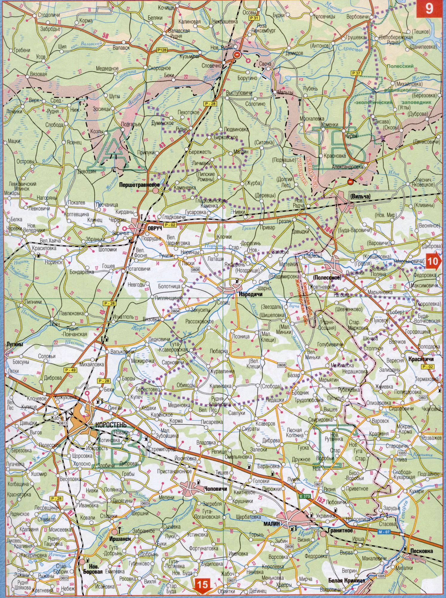
Road map of the Korosten district (consists of 2 parts, click on a part of the map to enlarge)
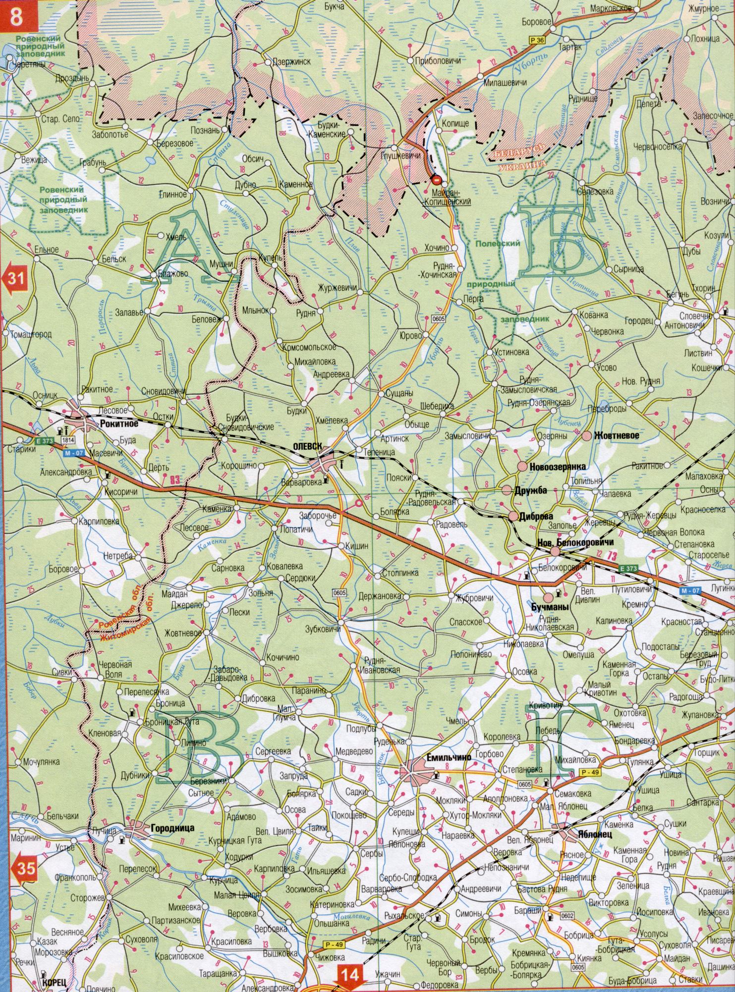
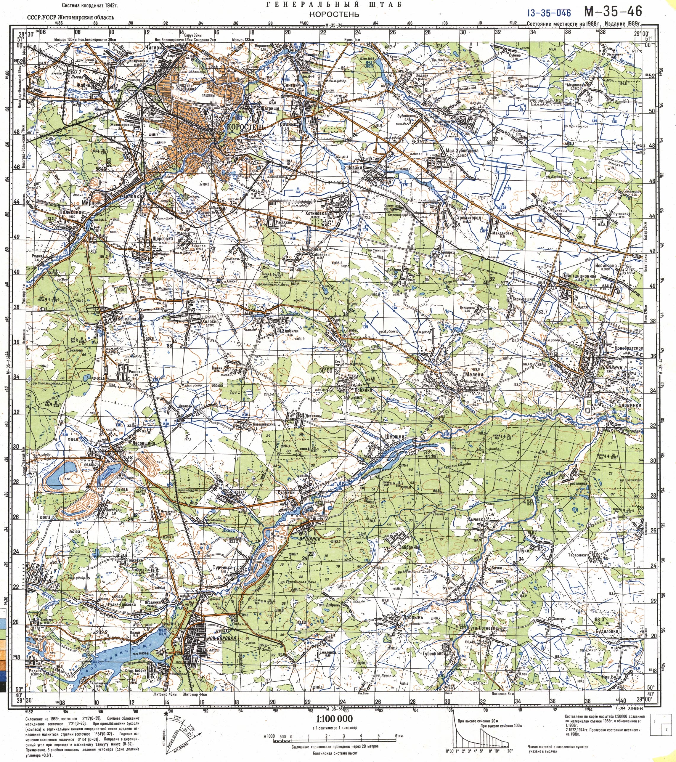
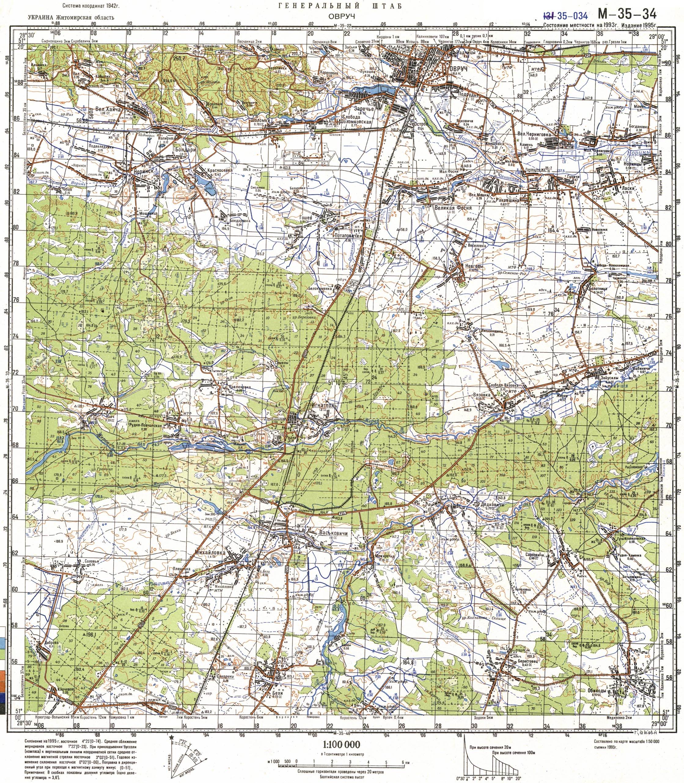
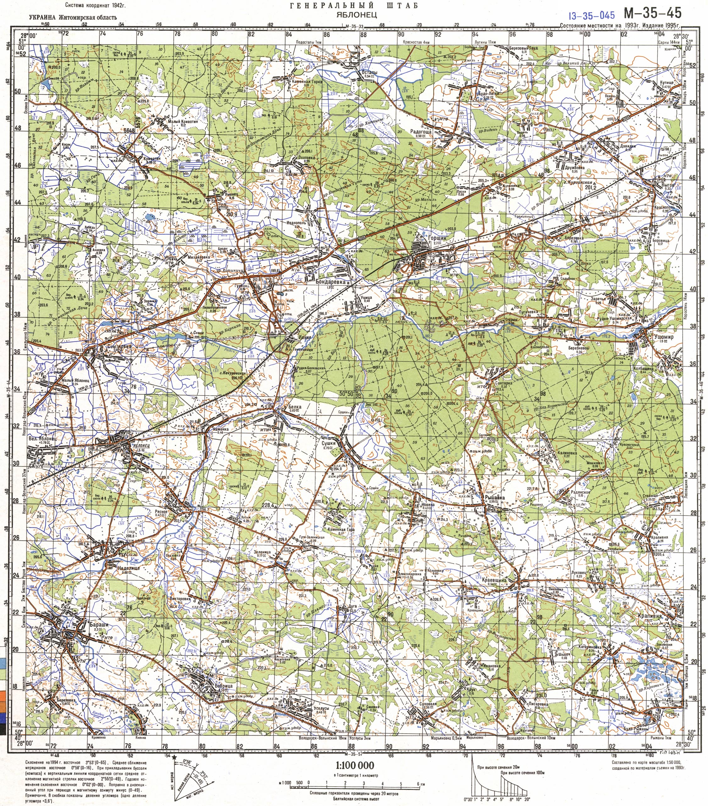
A very detailed topographical map of the Korosten District of the General Staff for 1993. (Consists of 3 parts, click on a part of the map to enlarge)
Satellite interactive map of the Korosten district from Google
Click the mouse to move/zoom in/zoom out